Edinburgh's urban expansion over the past two centuries has pushed developments onto the steep slopes of the Pentland Hills and the soft glacial tills of the Forth valley. These geological contrasts create distinct erosion patterns. On the south-facing slopes, seasonal rainfall saturates the upper soil layers. On the northern side, the old town's compacted fills and rock cuts behave differently. A proper soil erosion analysis in Edinburgh must account for these localised conditions. We combine field infiltration tests with a permeability field test to measure hydraulic conductivity on site. This data feeds directly into our erosion models. We also cross-check with infiltration tests on the same boreholes to validate the recharge rates.
On Edinburgh's steep till slopes, soil loss can exceed 12 t/ha/yr during a wet winter — erosion analysis is not optional.
Scope of work in Edinburgh
- Rainfall simulation at 40 mm/h for 30 min
- Rill erosion depth measured every 5 min
- Sediment concentration by oven-dry method
Typical technical challenges in Edinburgh
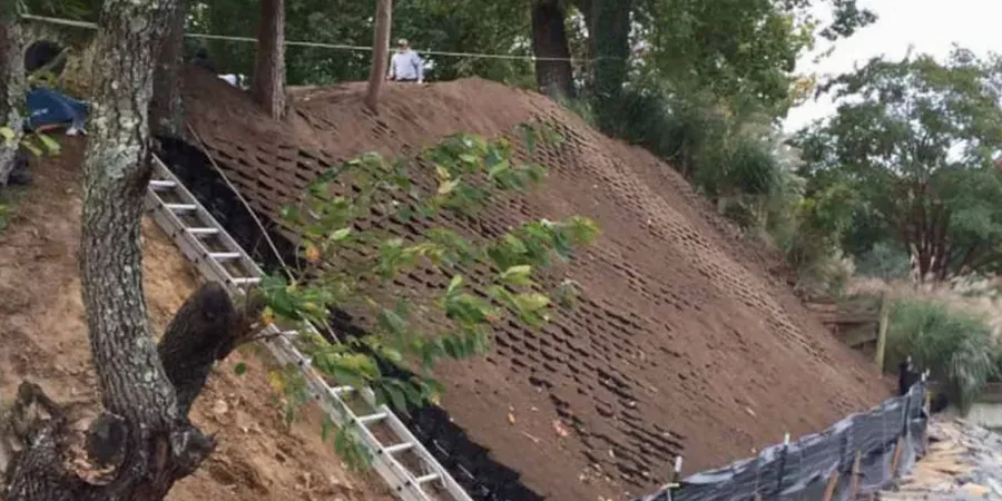
On Edinburgh's steeper terraces, we often see sheet erosion turn into gully erosion within a single storm event. The glacial till here has low infiltration capacity once the top 5 cm saturate. If the site lacks a proper erosion control plan, the runoff carries fine silts straight into the Water of Leith. That triggers compliance issues under SEPA regulations. Our soil erosion analysis in Edinburgh flags these critical zones early. We map the erosion risk polygons and recommend sediment basins or silt fences before earthworks begin. It saves time and avoids fines.
Our services
We offer two complementary services for erosion control on Edinburgh construction sites.
Erosion Risk Mapping
GIS-based mapping of erosion potential using slope, soil type, and rainfall data. Delivered as CAD layers for your drainage and sediment control design.
Sediment Control Design
Design of silt fences, sediment basins, and check dams sized to the site's runoff volume. Includes hydraulic calculations per BS EN 12056-3.
FAQ
How long does a soil erosion analysis take in Edinburgh?
A standard field test with rainfall simulation and sediment sampling takes one full day on site. Reporting adds two working days. For large sites with multiple slope profiles, allow three to five days total.
What regulations apply to soil erosion on Edinburgh construction sites?
SEPA's Pollution Prevention Guidelines (PPG5) apply, along with BS 5930:2015 for site investigation. If the site drains into the Water of Leith or a designated bathing water, additional SEPA consent may be required.
Can soil erosion analysis be combined with a geotechnical investigation?
Yes. We often integrate erosion testing with standard borehole logging and in-situ permeability tests. The same borehole can provide infiltration data, soil classification, and erosion potential — saving time and reducing site visits.